
Just south of Utah, the Arizona Strip is home to The Vermillion Cliffs National Monument. The Grand Canyon isolates the Arizona Strip from the rest of Arizona, making it among the most remote and rugged public land in the lower 48 states.
Established in 2000, the Vermillion Cliffs National Monument encompasses over 280,000 acres. Within this rugged, protected area are numerous photography opportunities. Some of the most famous are The Wave, White Pocket, and Paw Hole.
The Wave in the Vermillion Cliffs
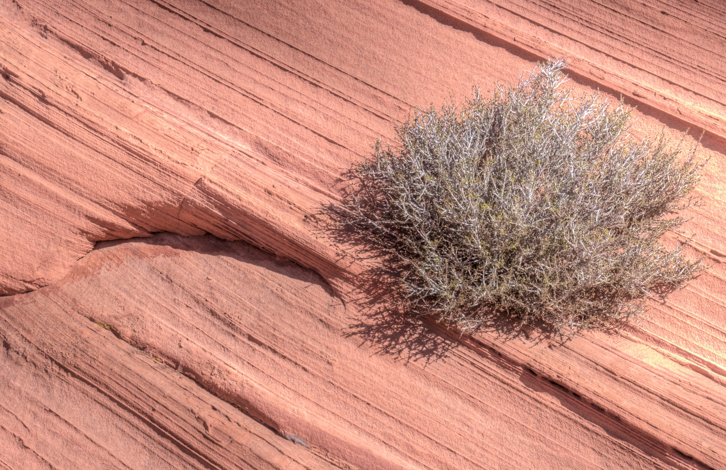
One of the most famous and photogenic areas within Vermillion Cliffs is The Wave. In order to access this area, you must obtain a permit issued by the BLM, in addition to a 6-mile round trip hike across slick rock.


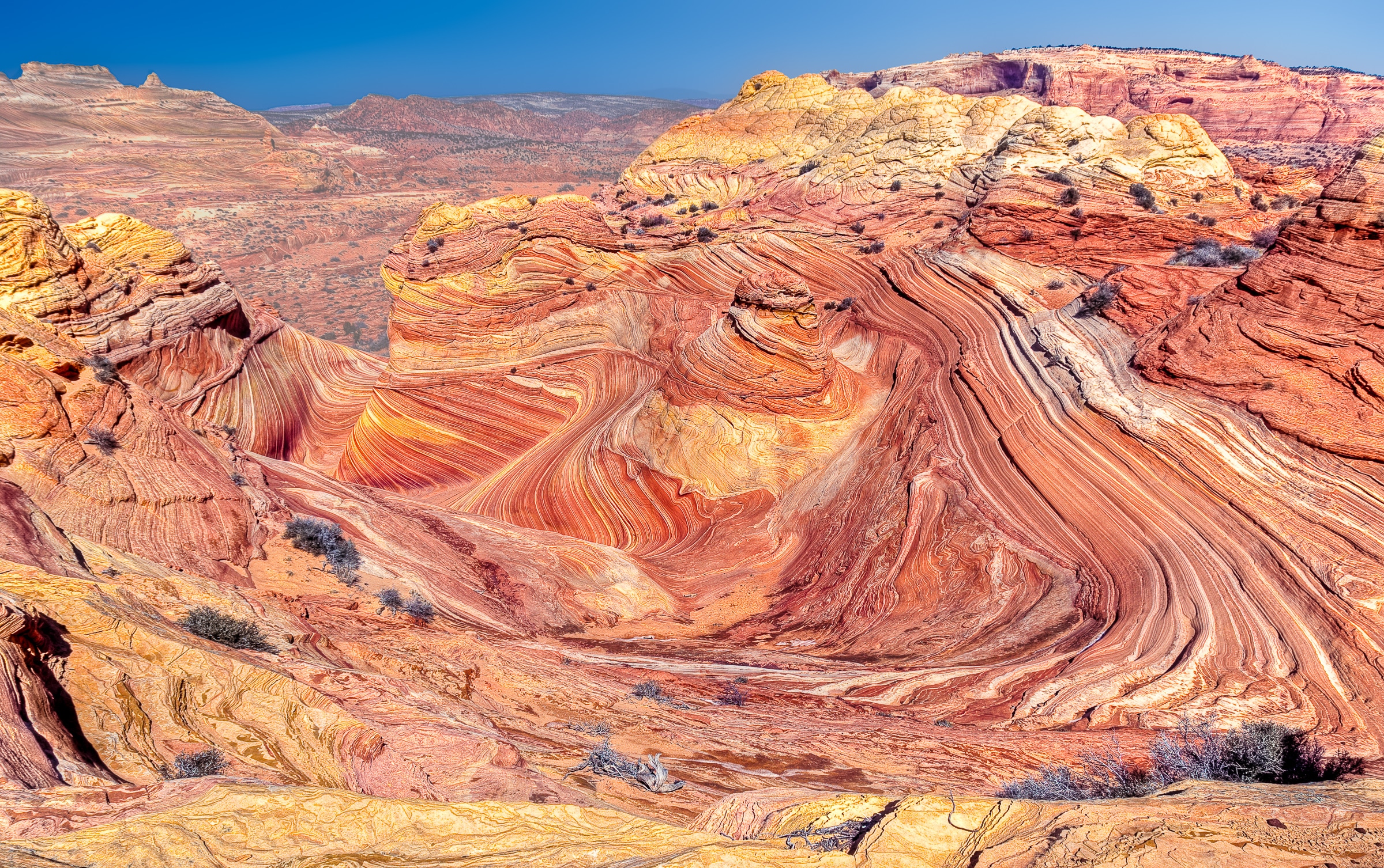
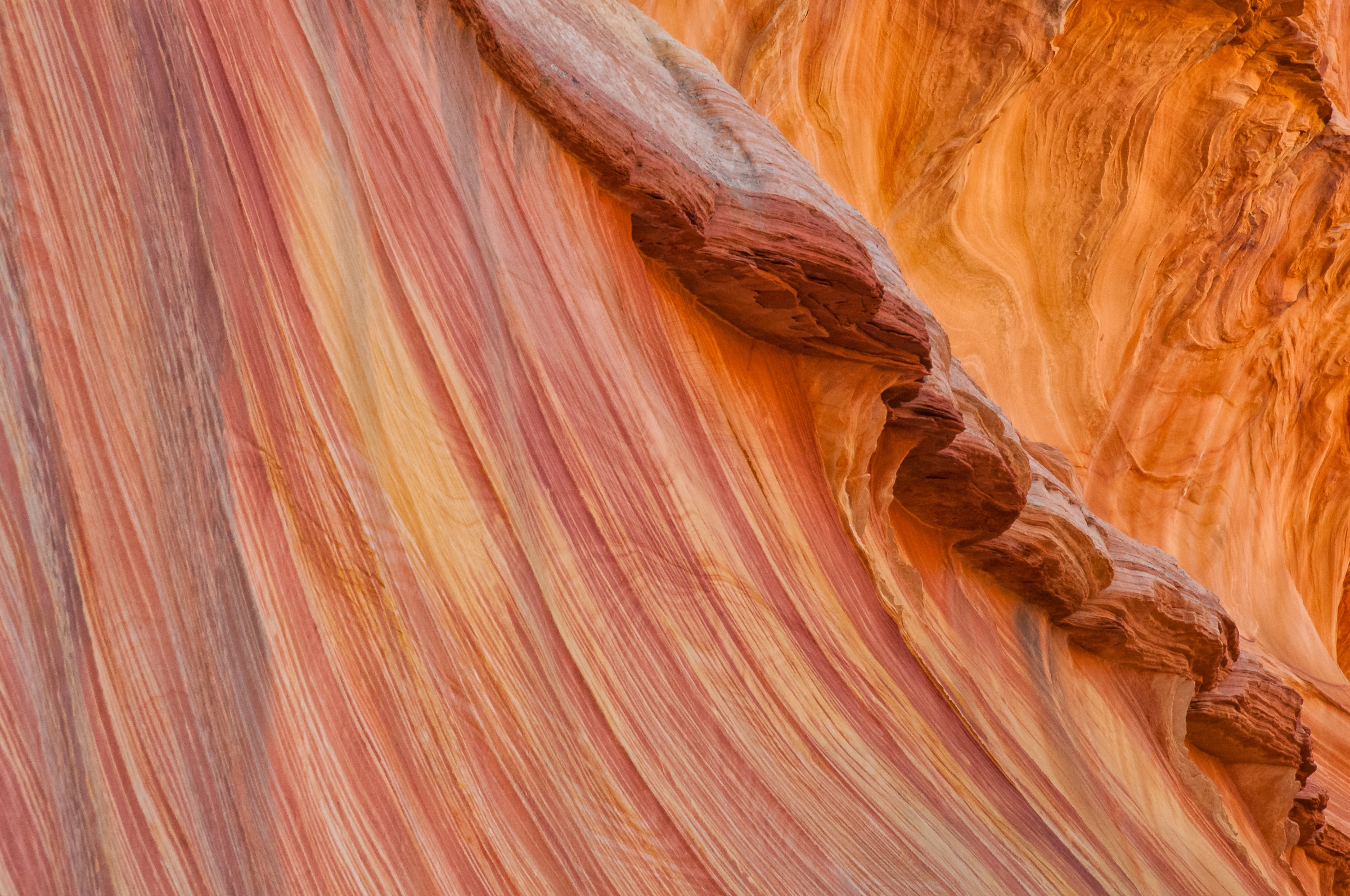
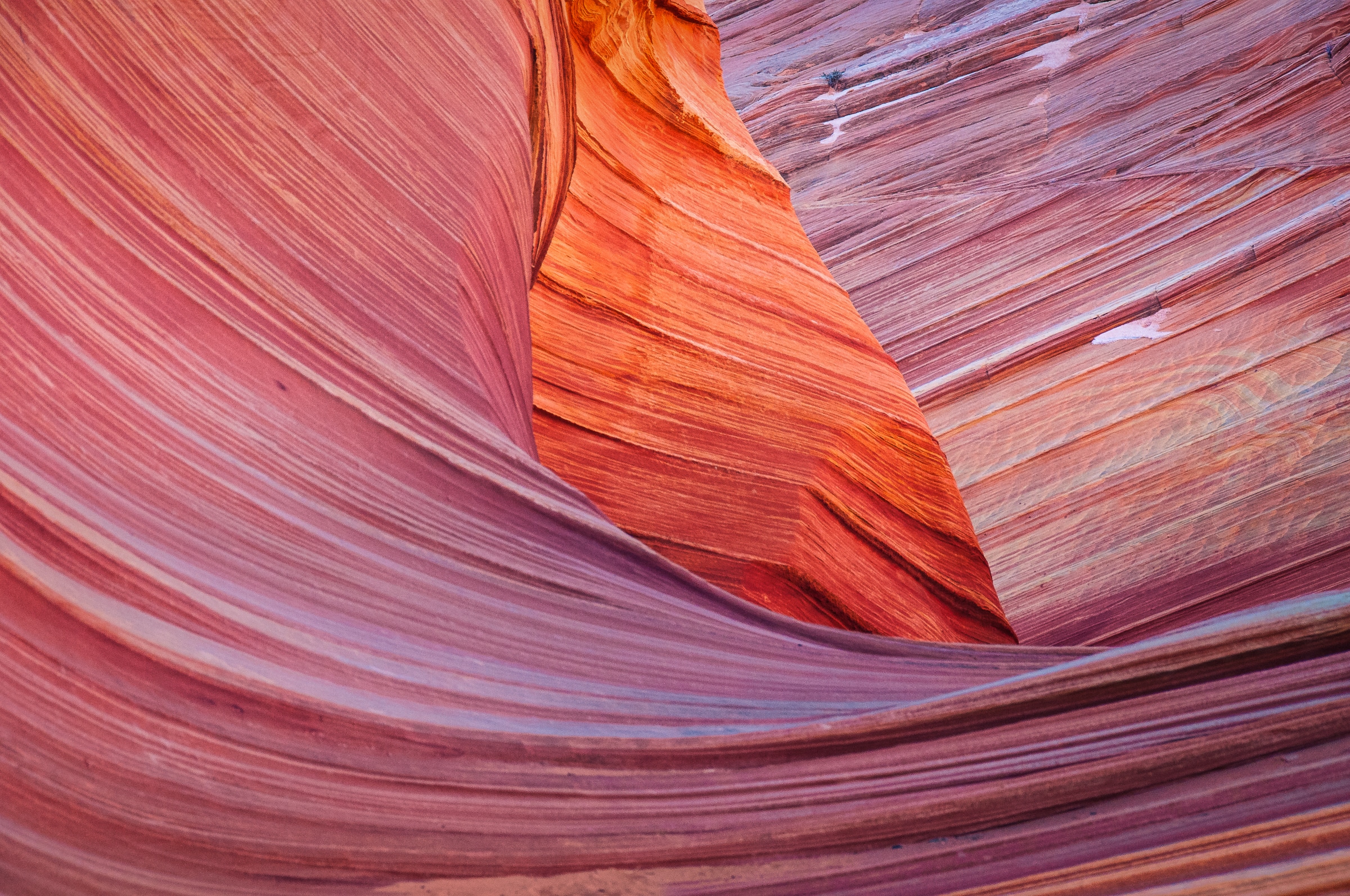
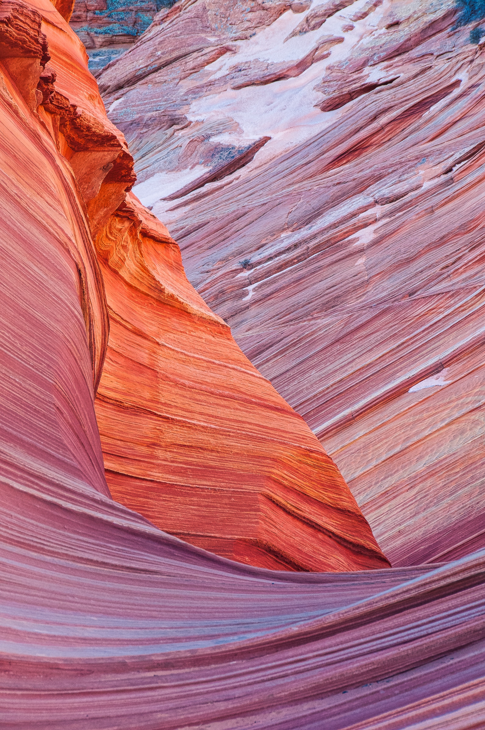
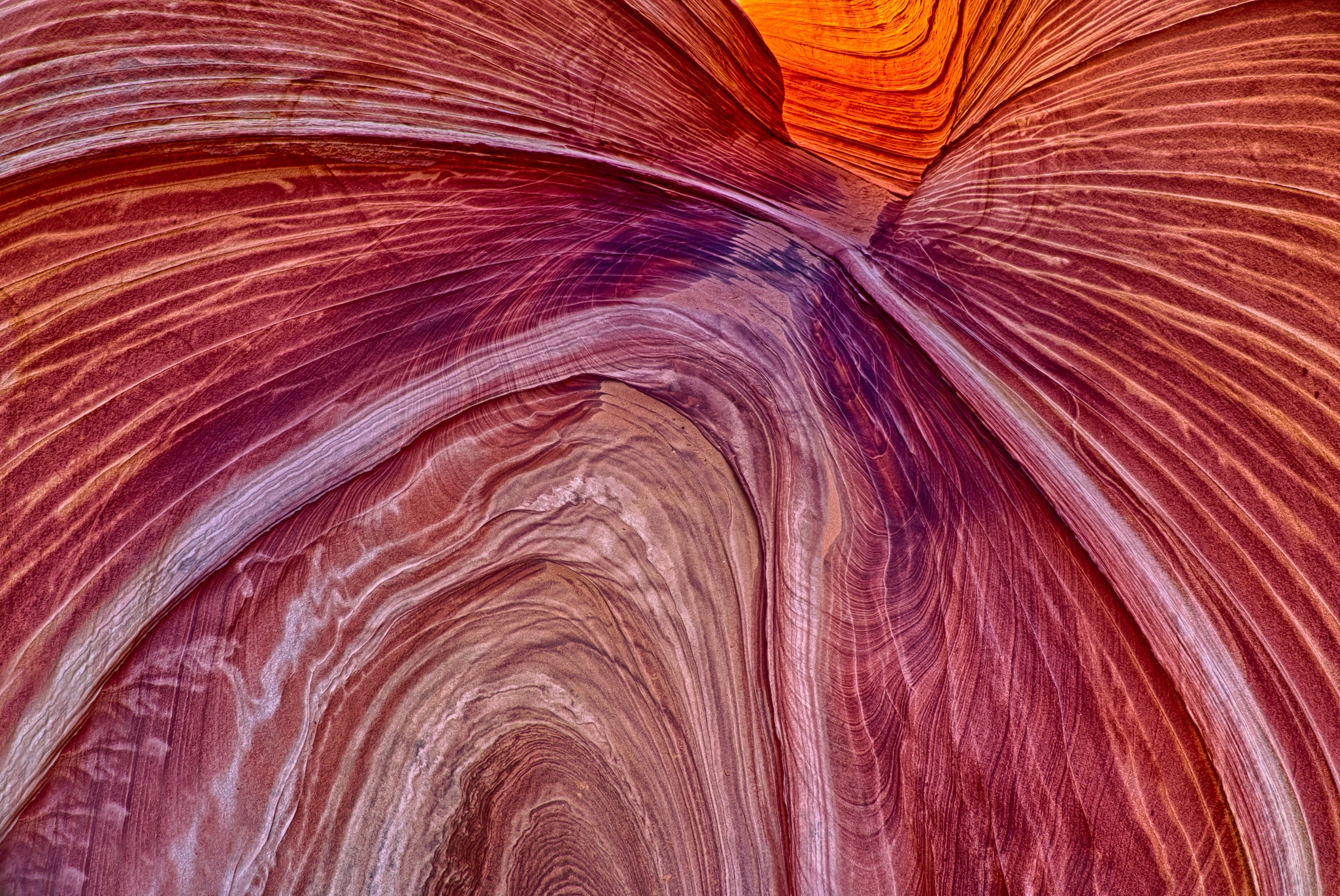
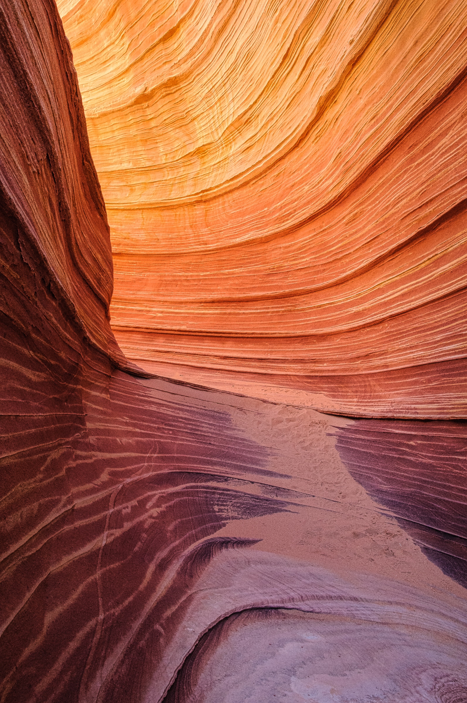
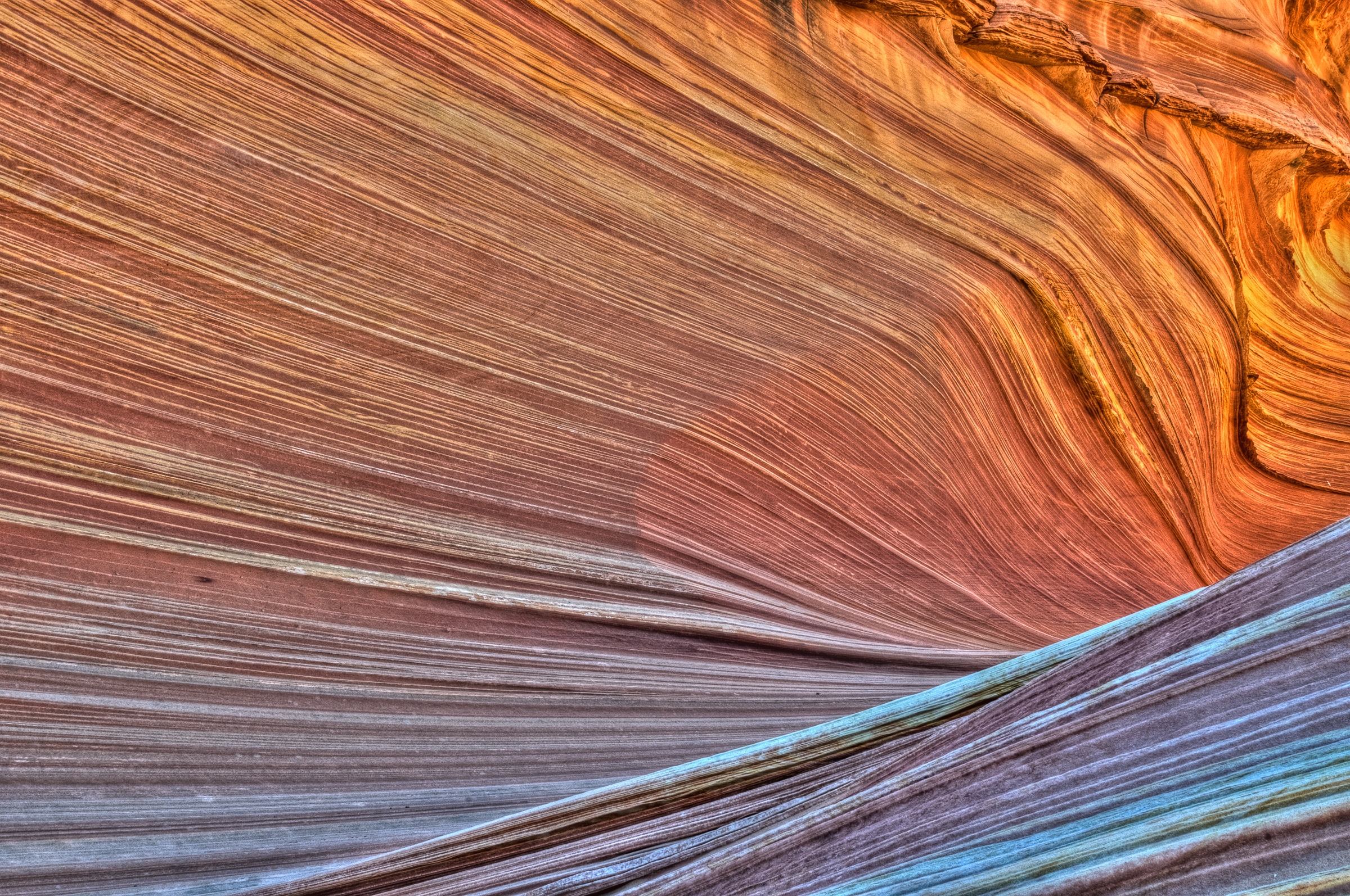
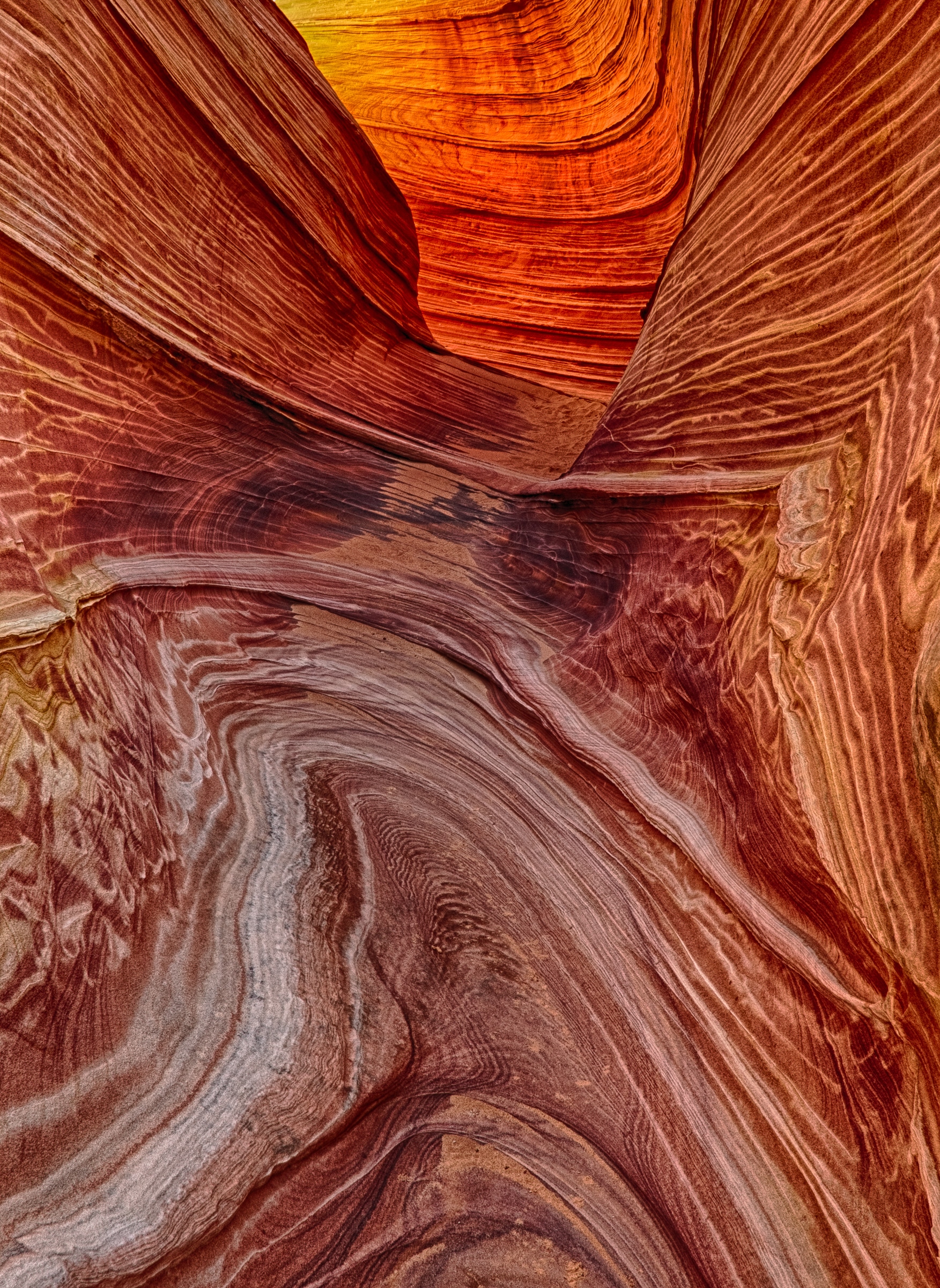
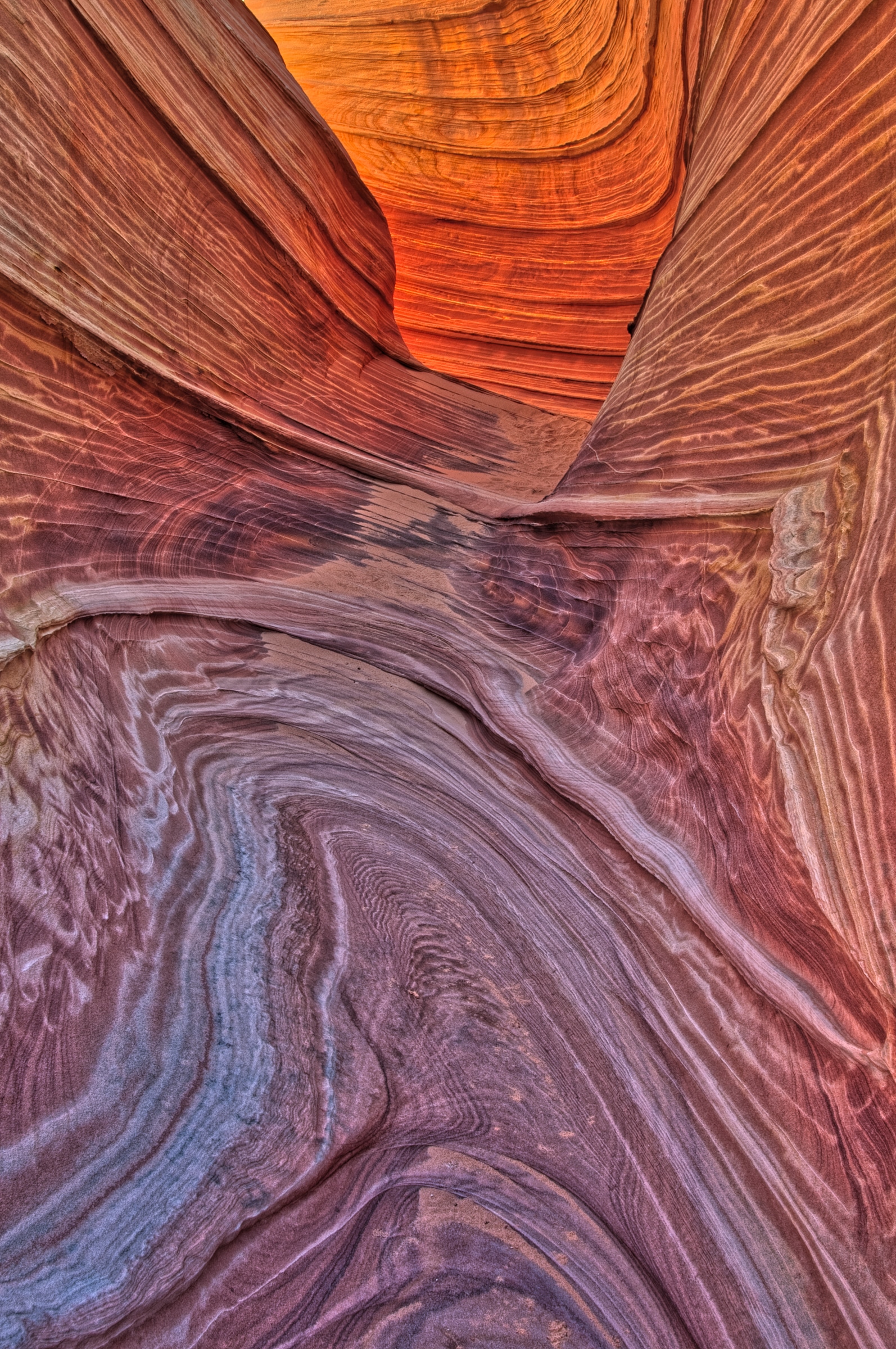
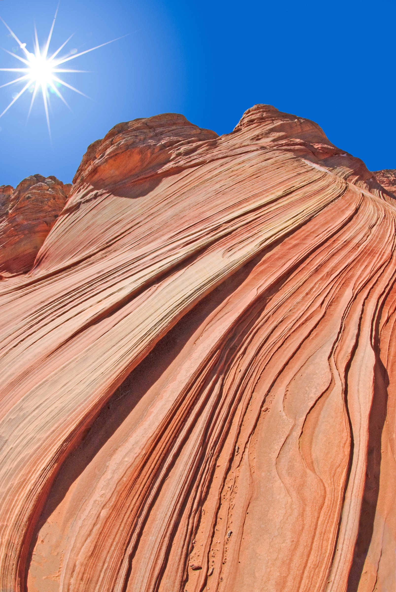
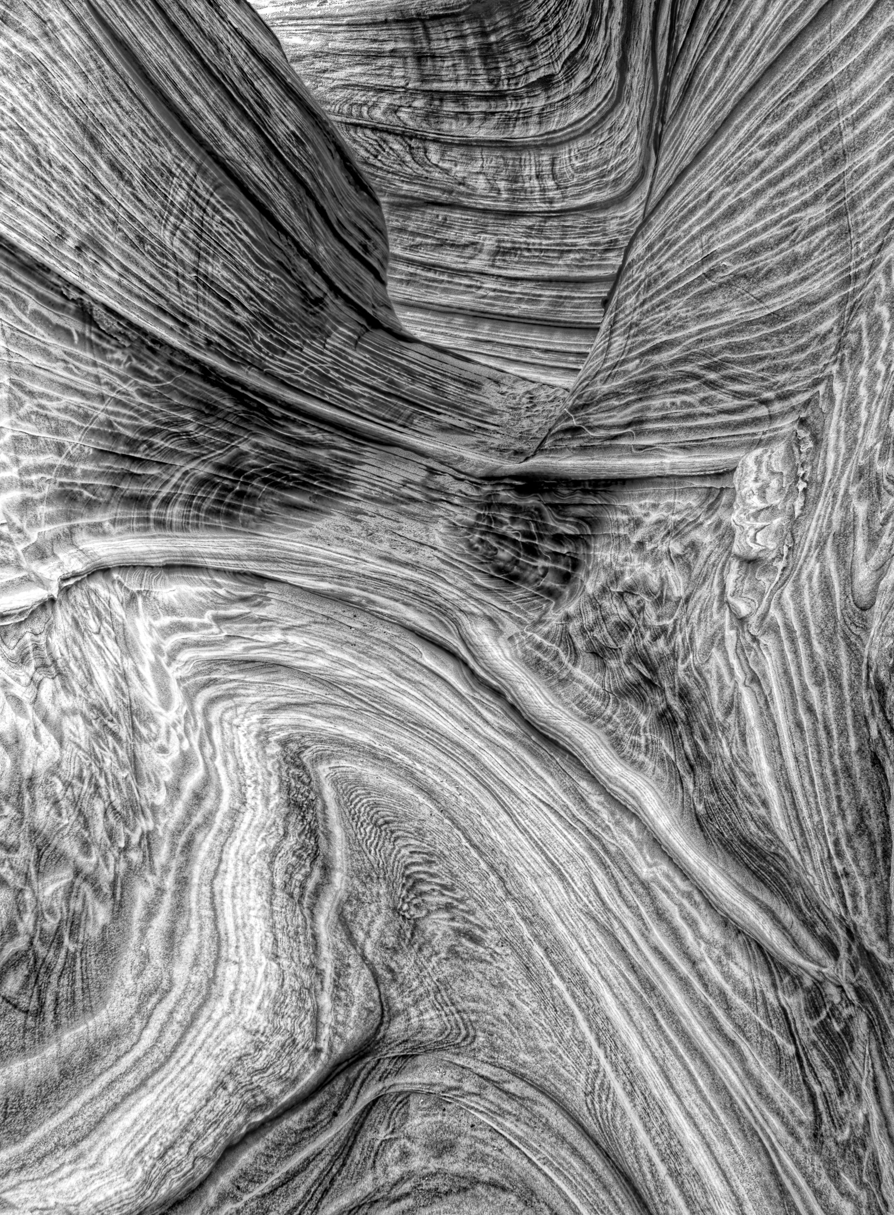
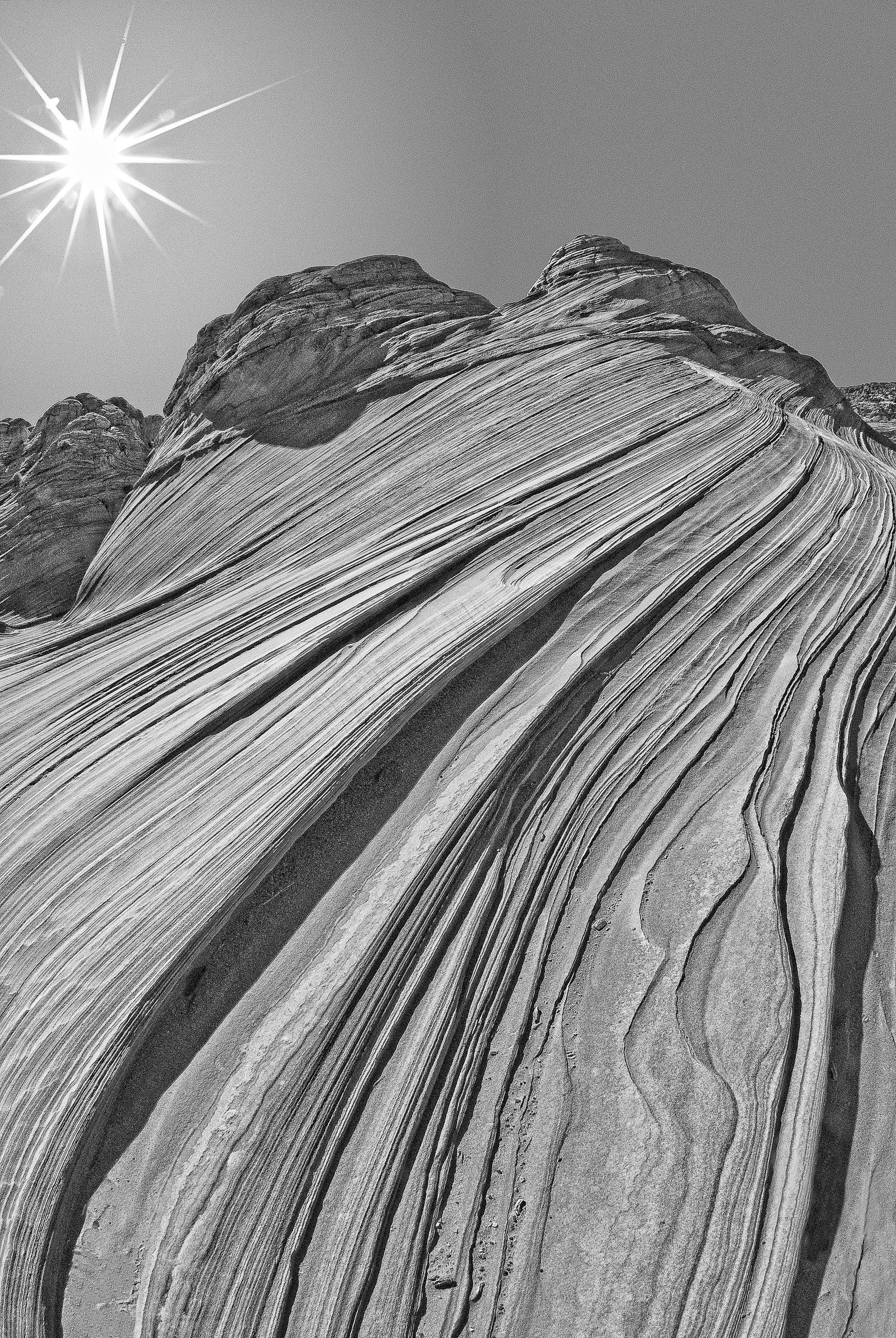
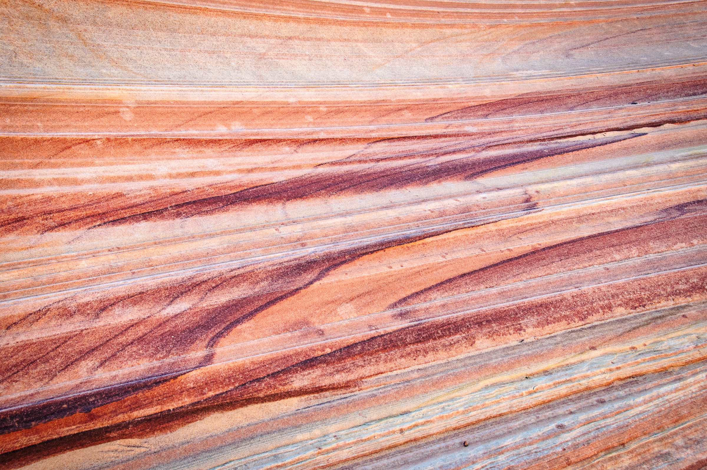
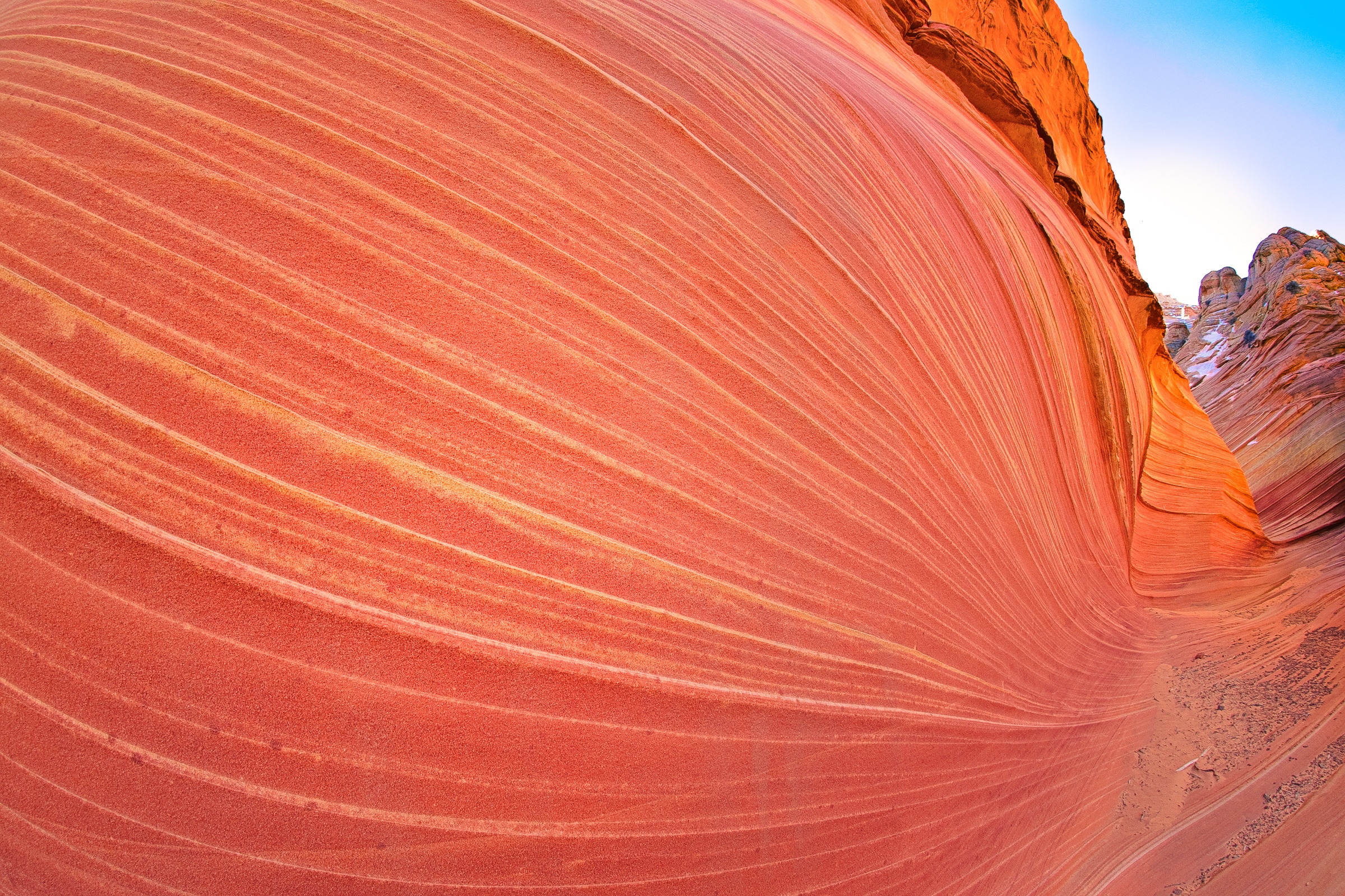
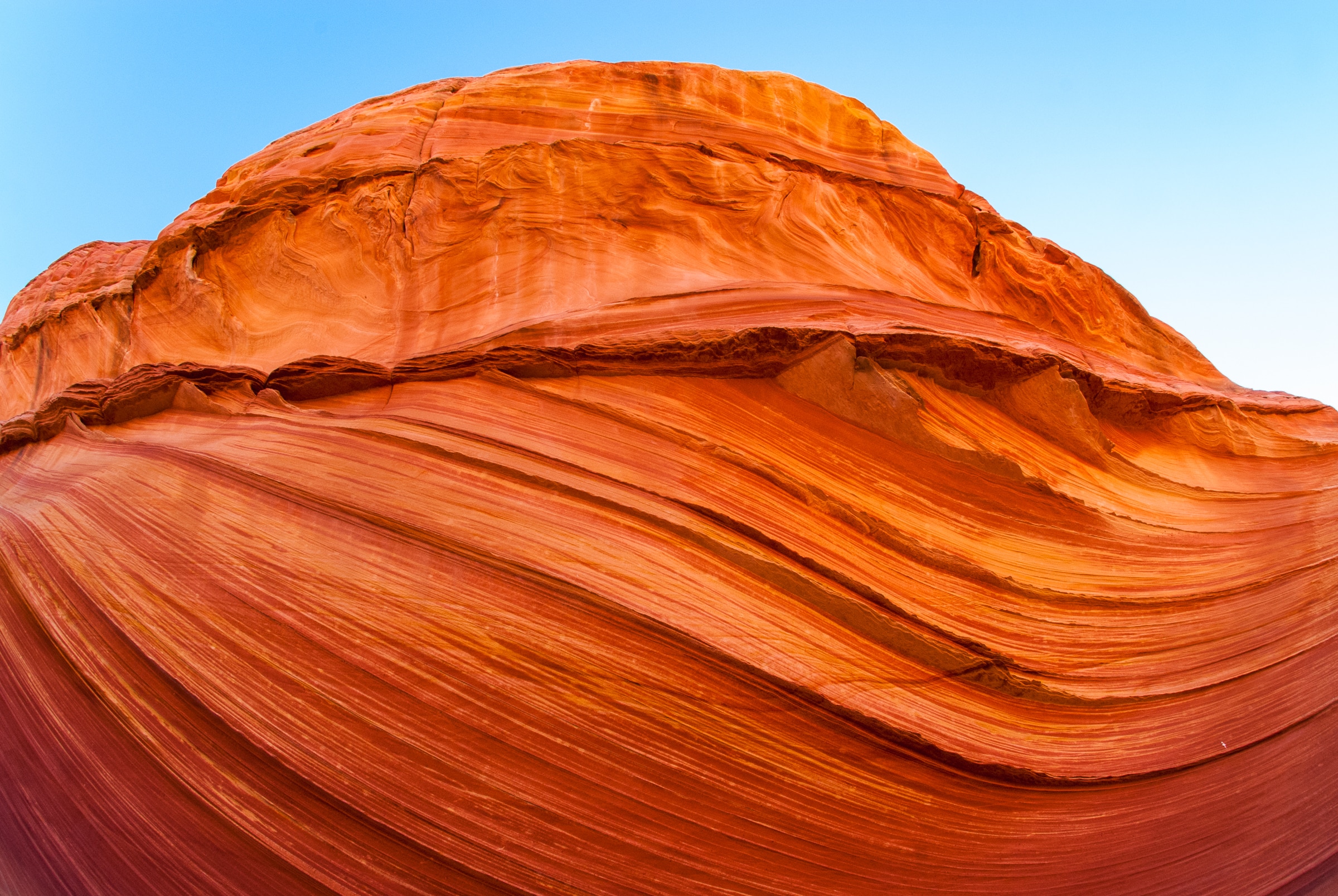
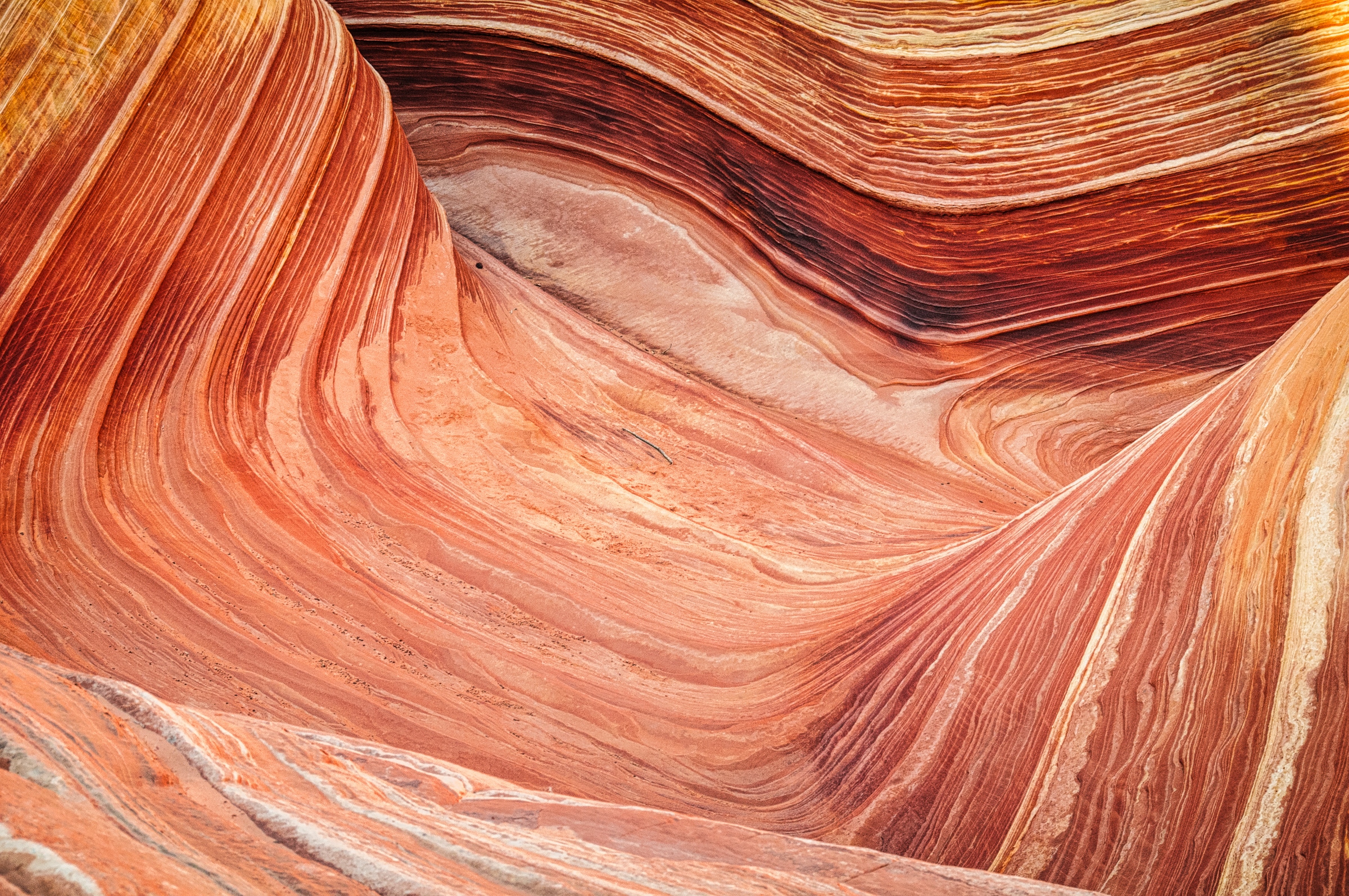
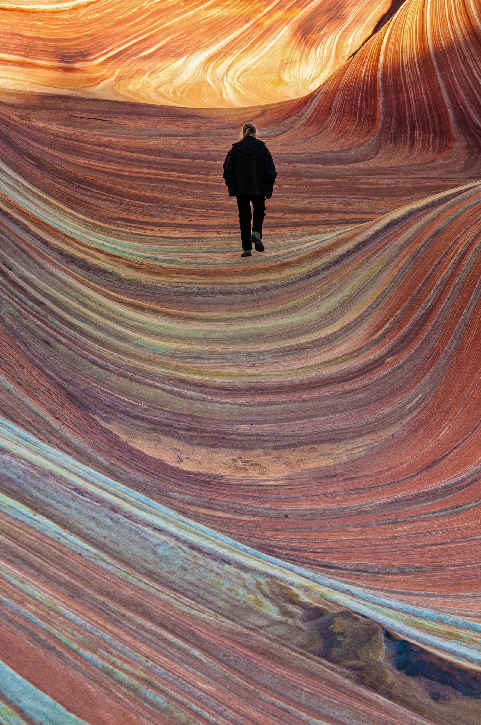
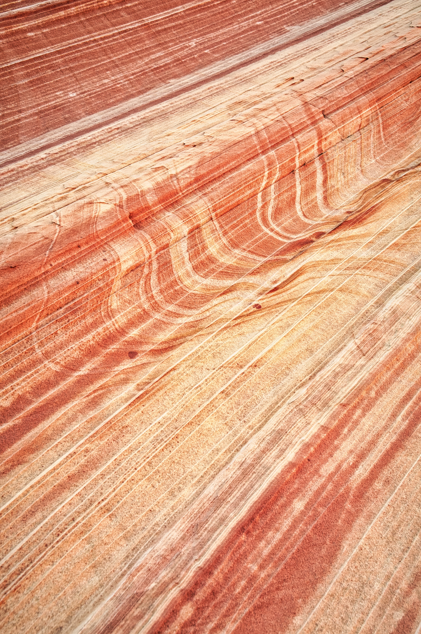
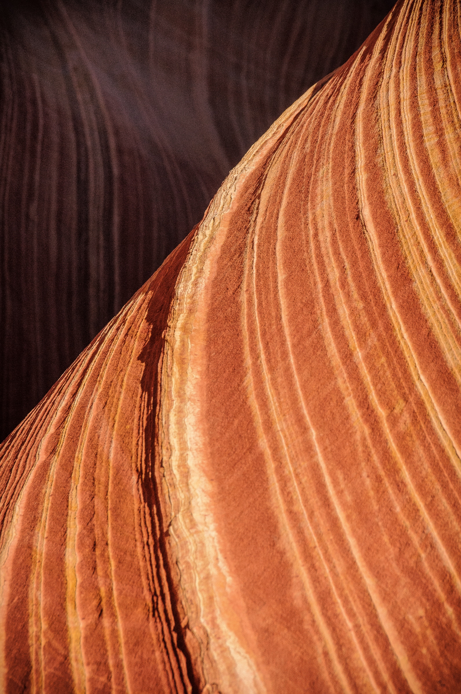
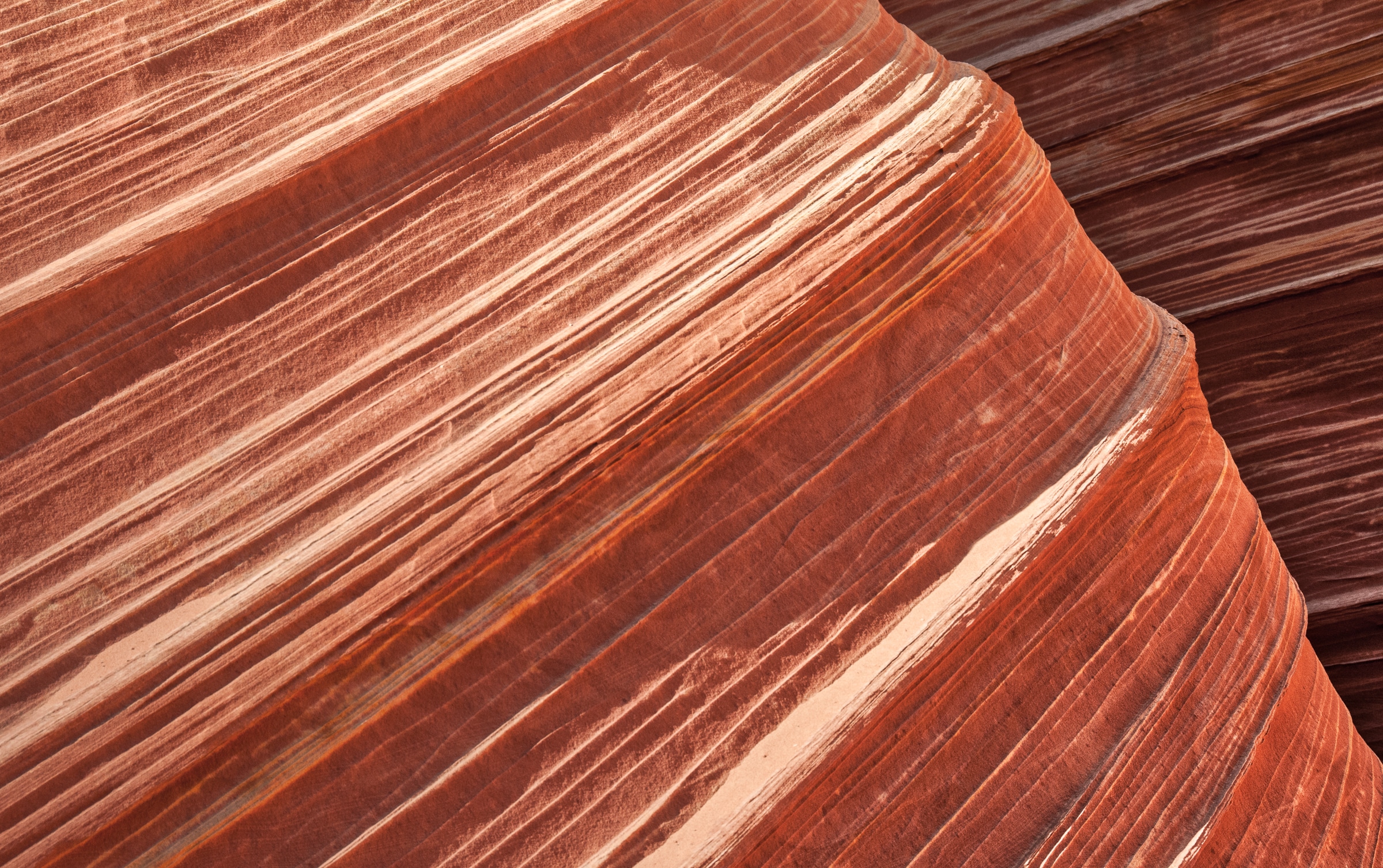
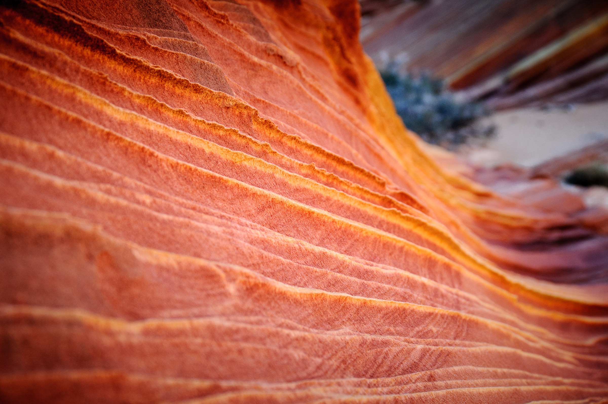
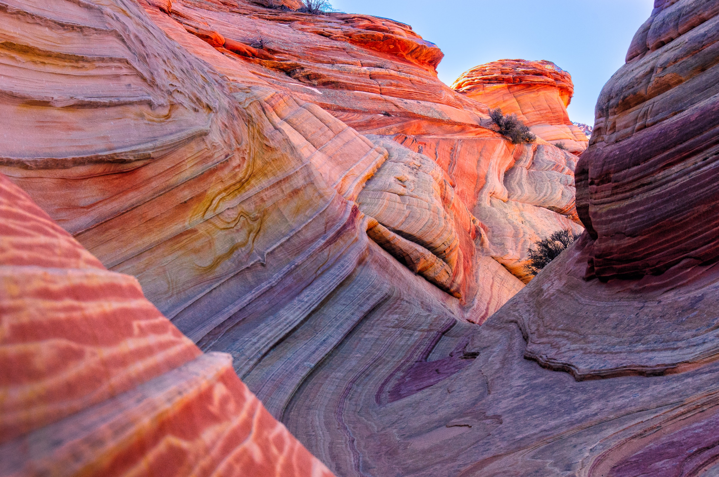
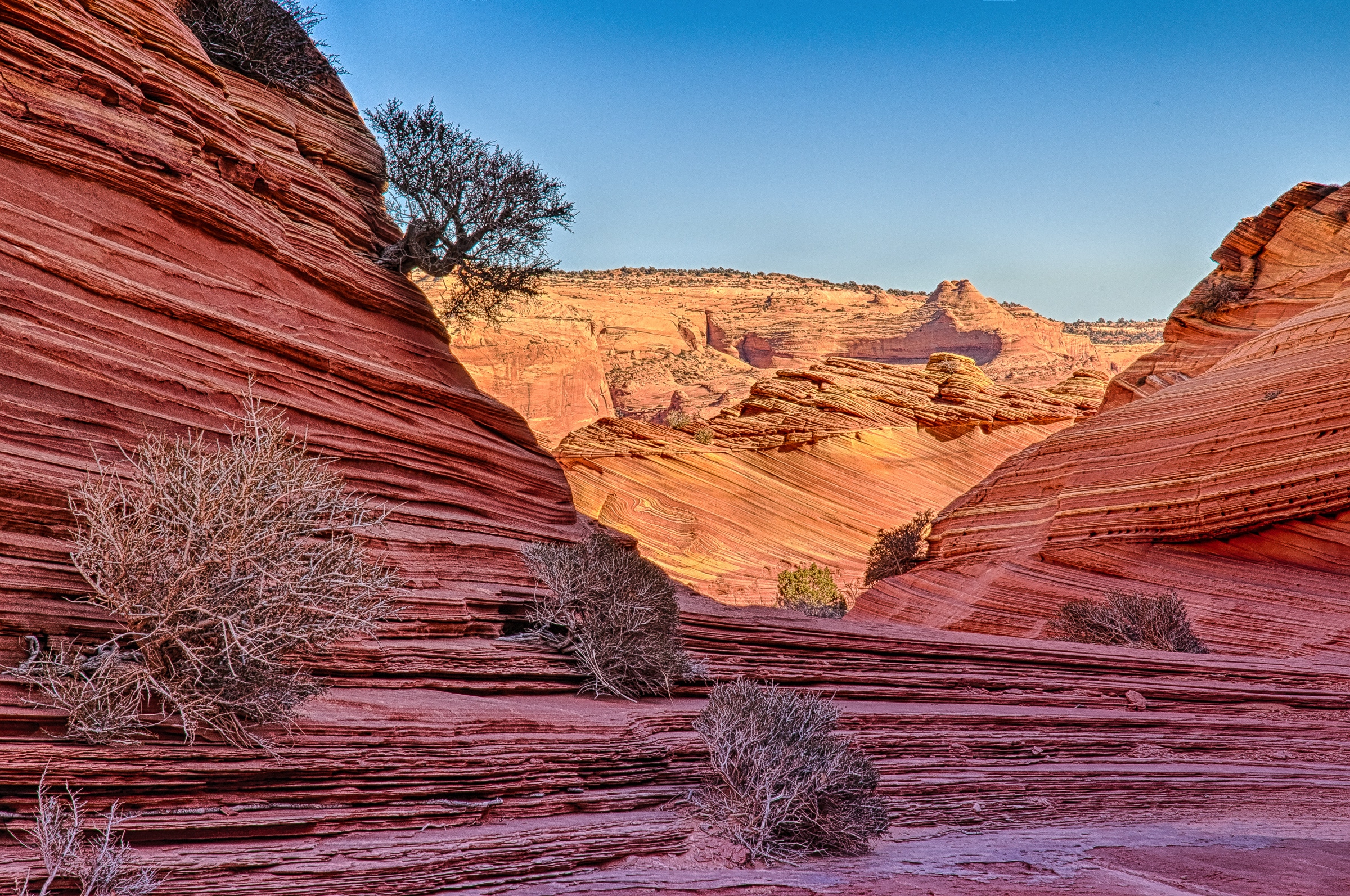
Two intersecting troughs form the incredible rock formation known as The Wave. The troughs were initially caused in the distant past by runoff from flash floods that eroded joints in the Jurassic-age Navajo Sandstone. The area around these troughs became drier and the water erosion stopped, to be replaced by wind erosion. The brilliant red colors are due to the relative permeability of the layers of sandstone, combined with the action of groundwater on these various layers.
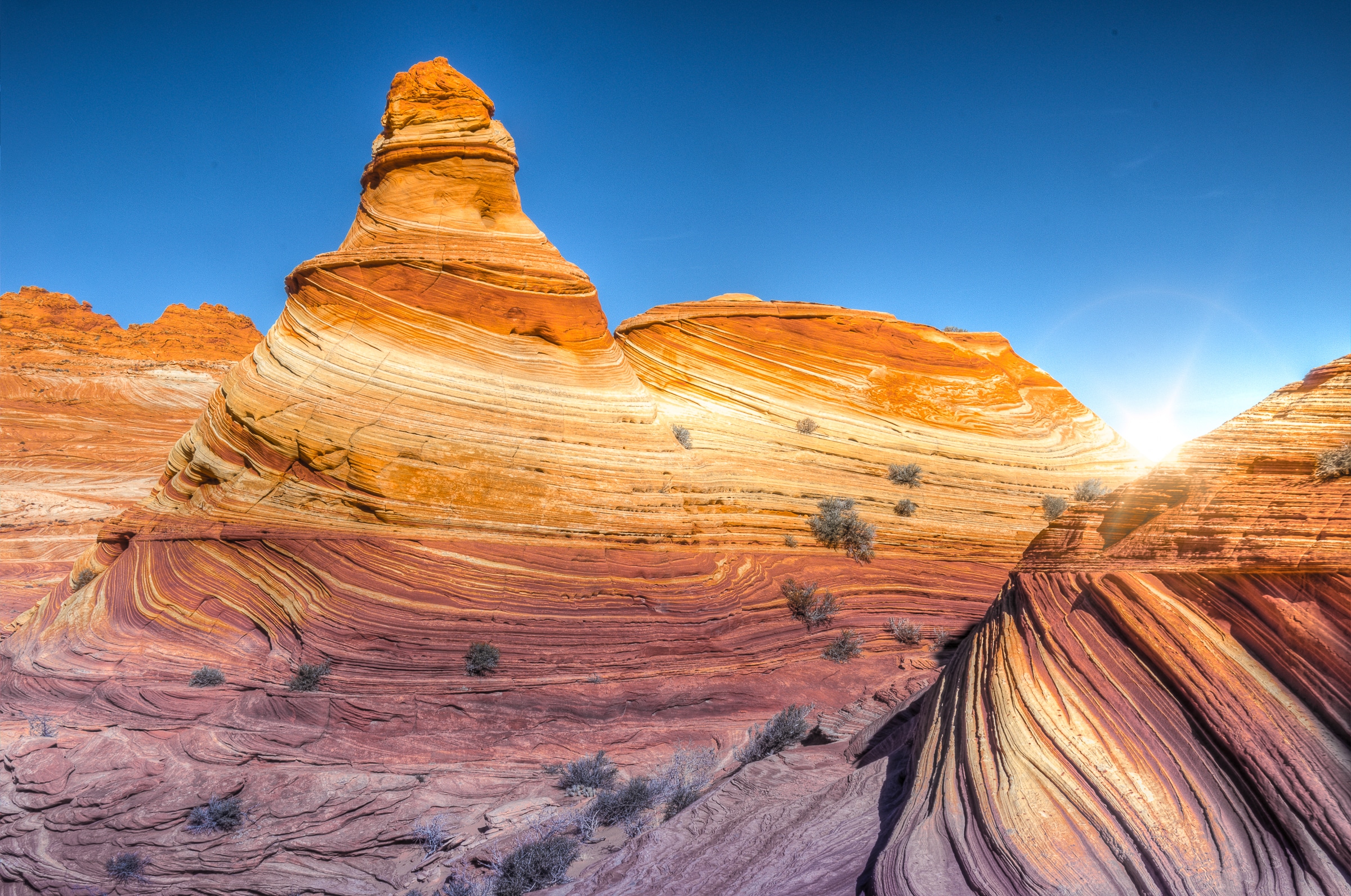
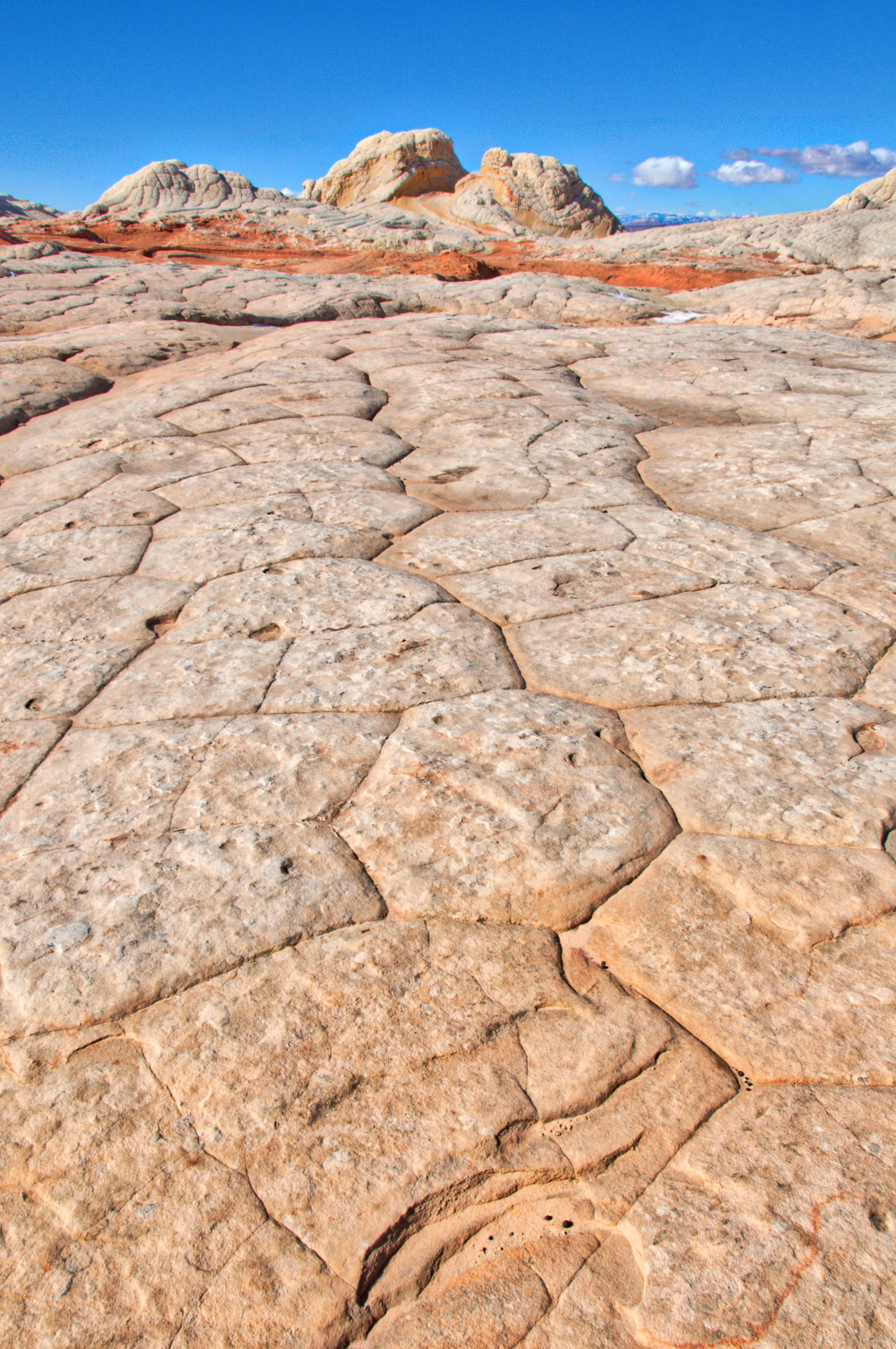
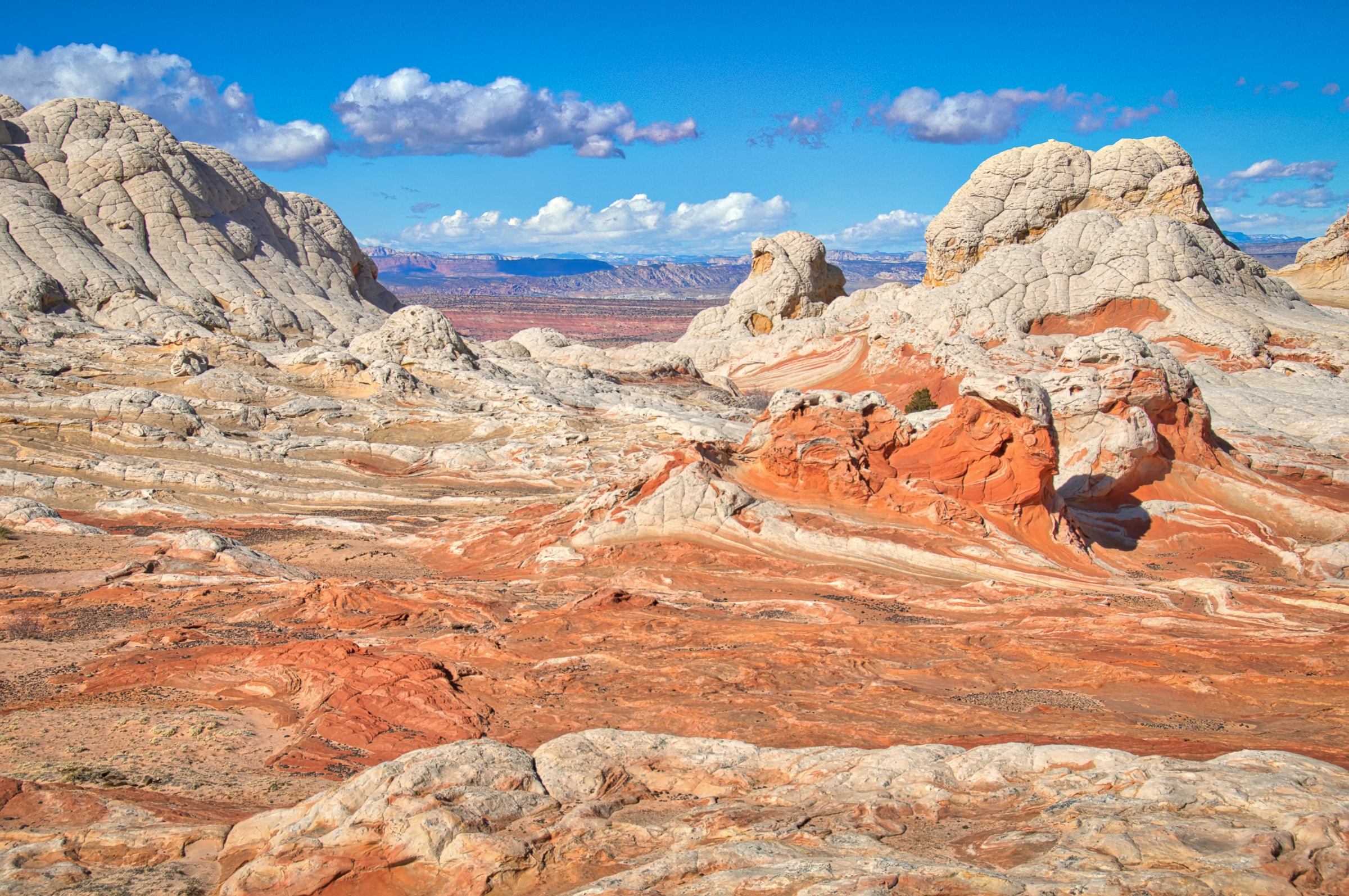
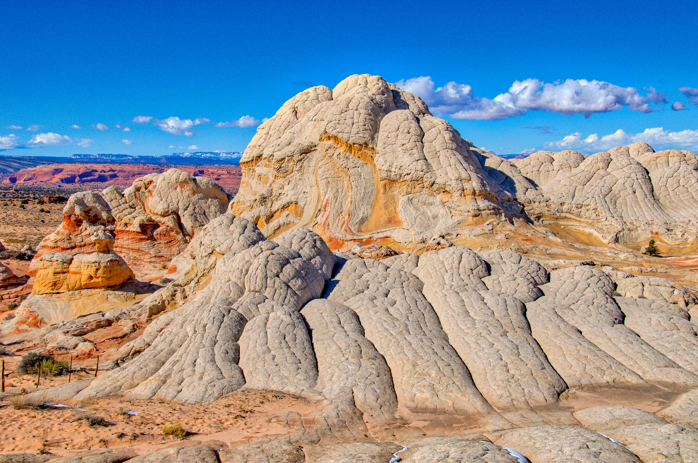
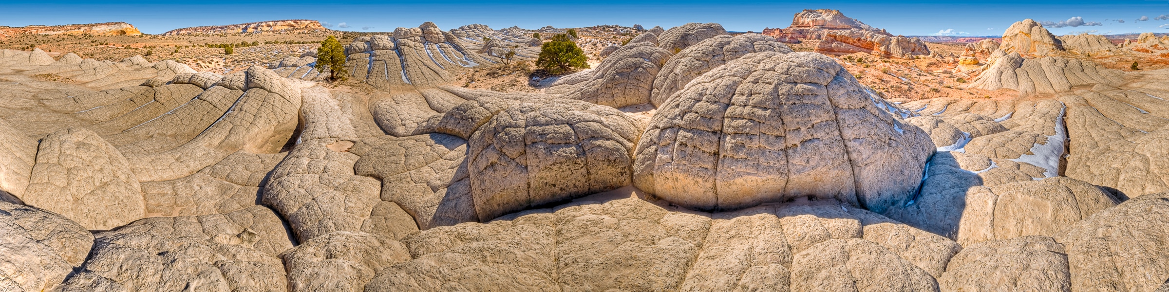
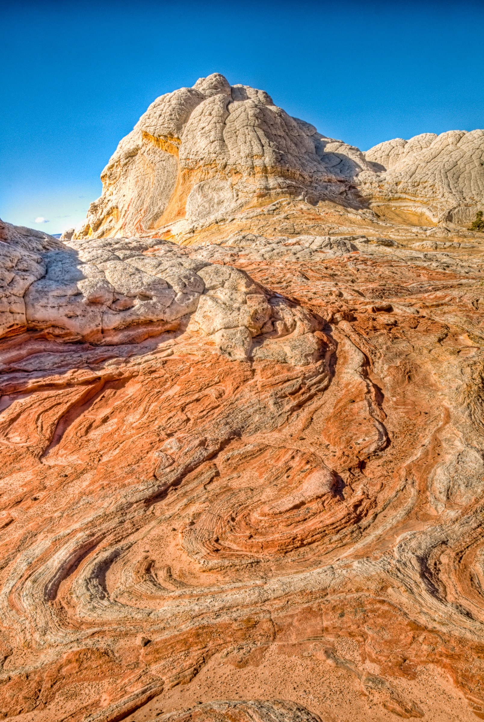
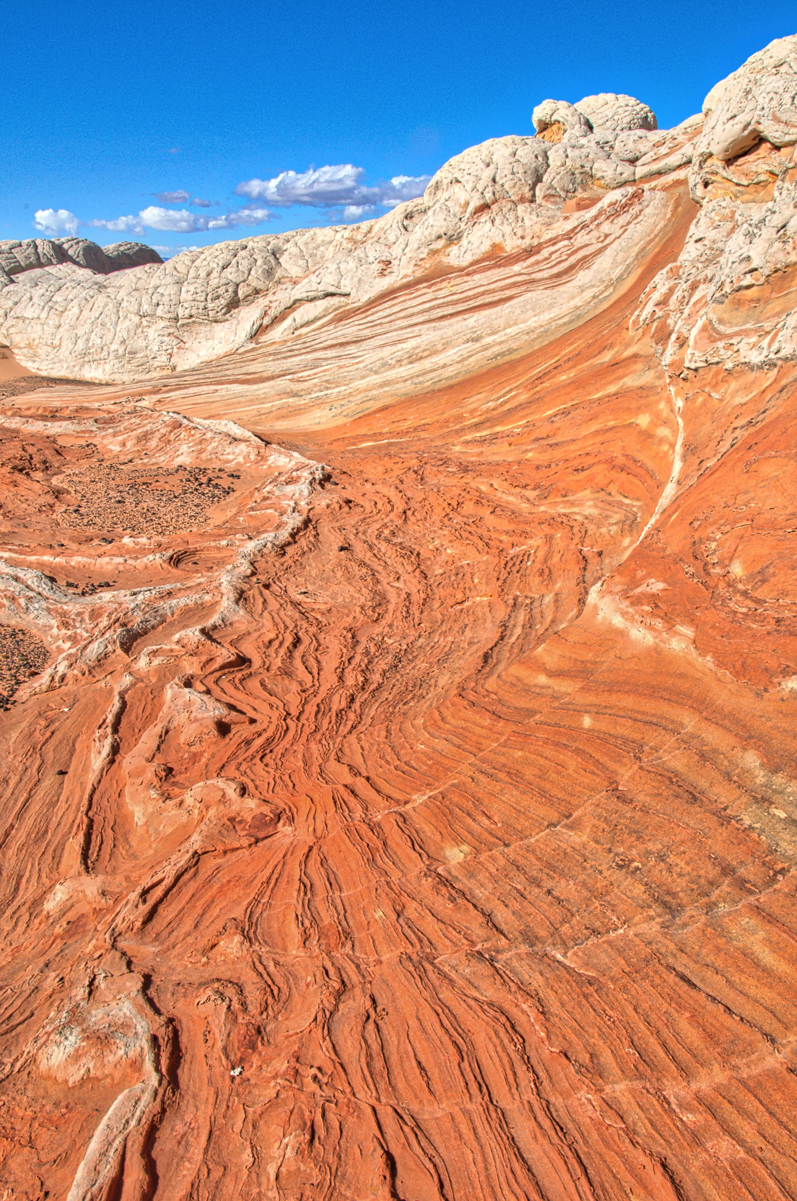
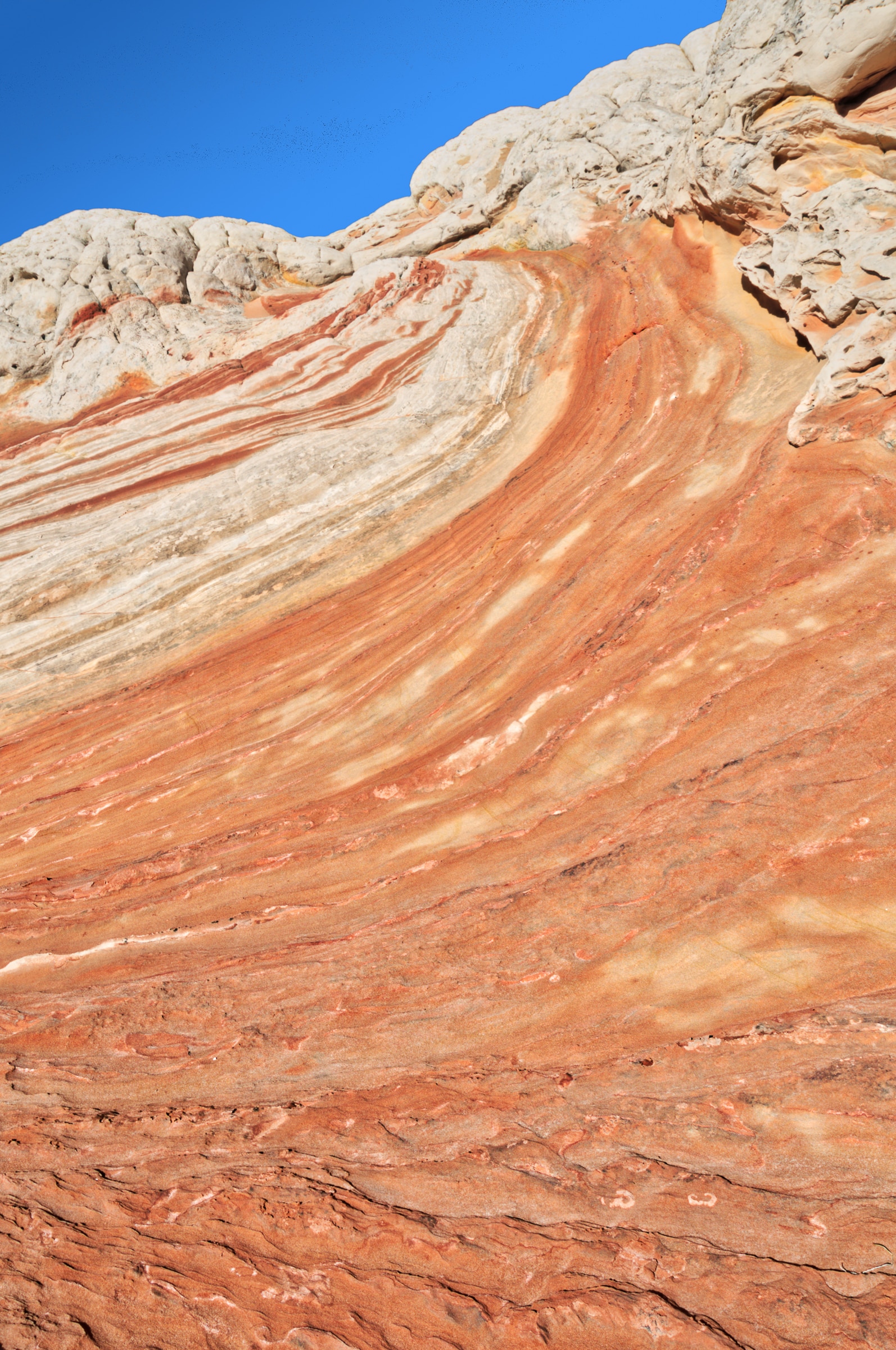
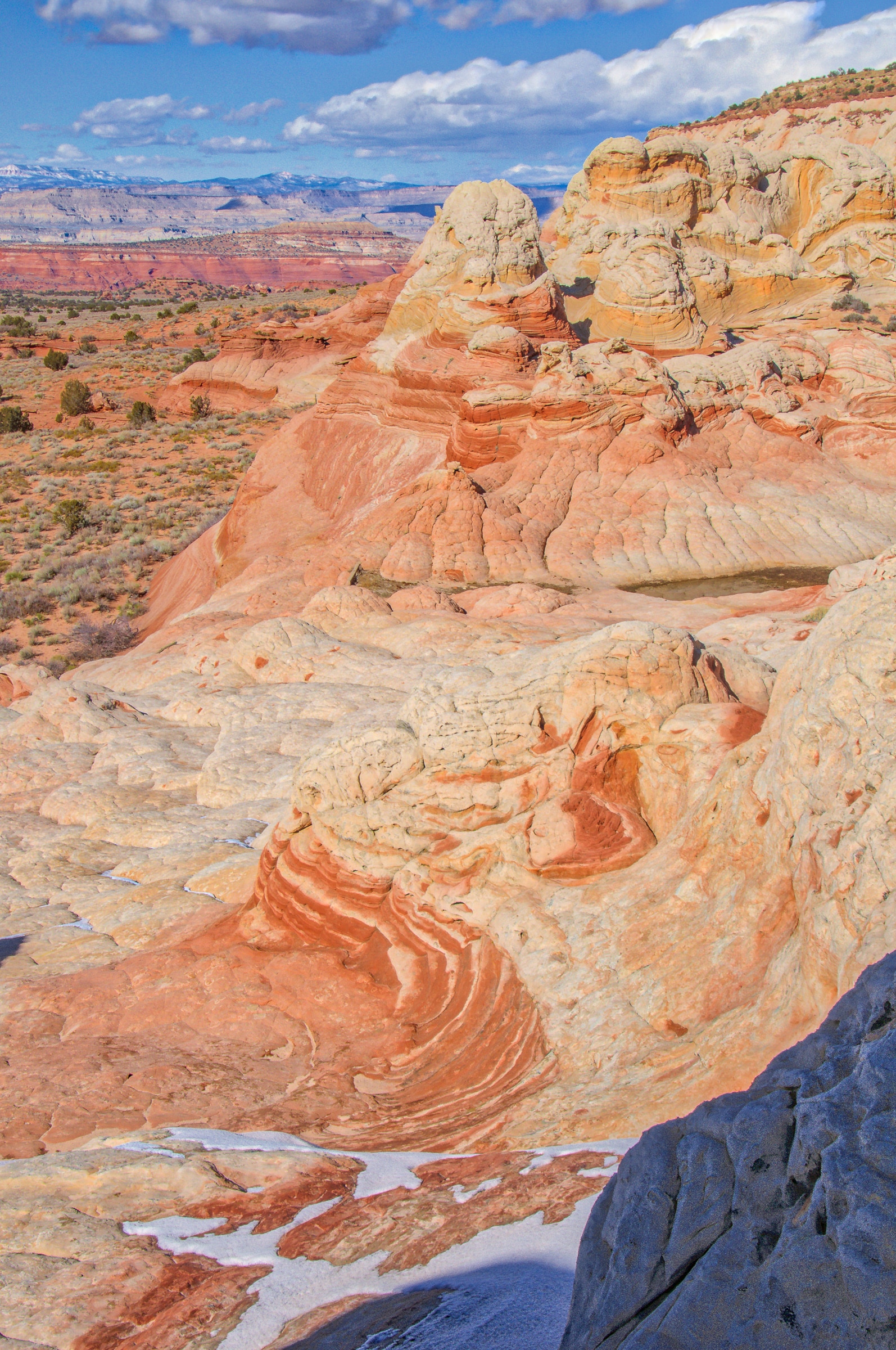
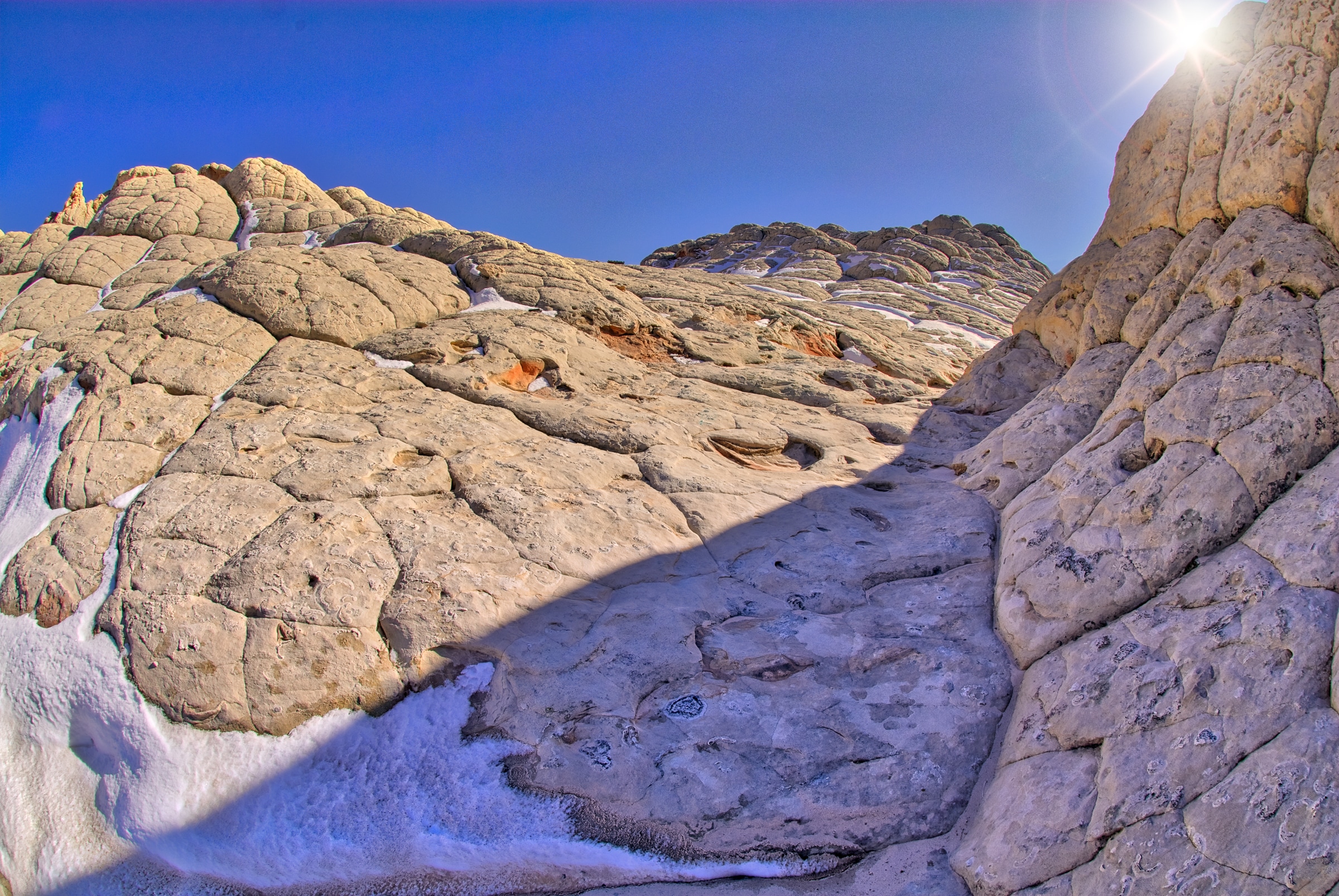
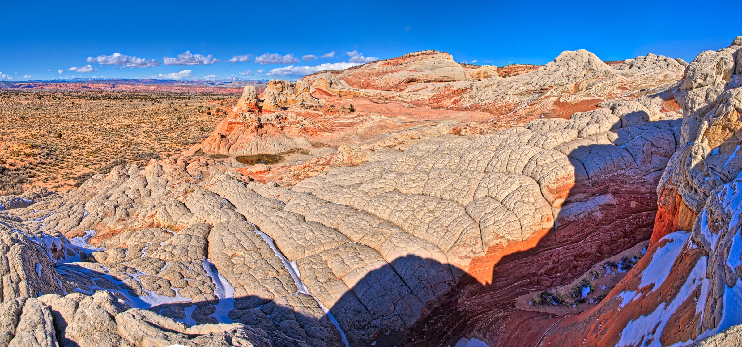
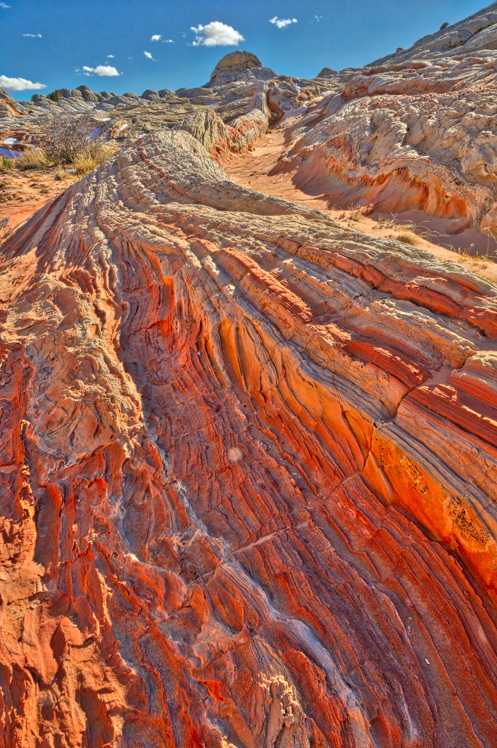
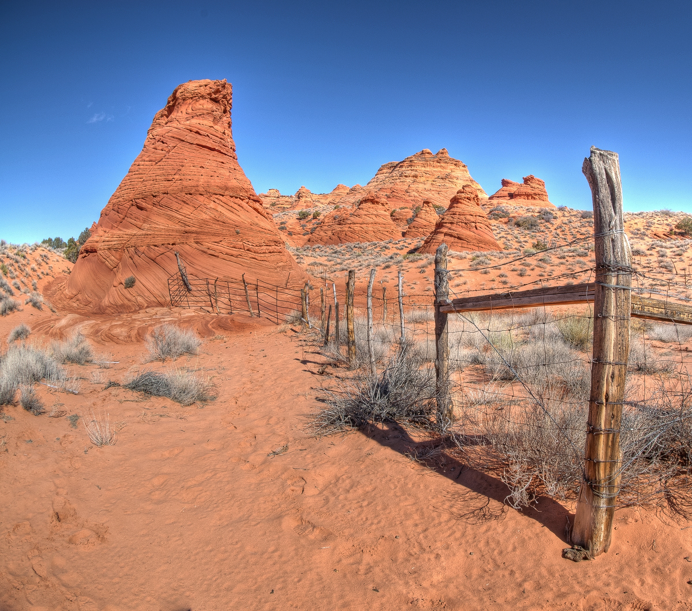
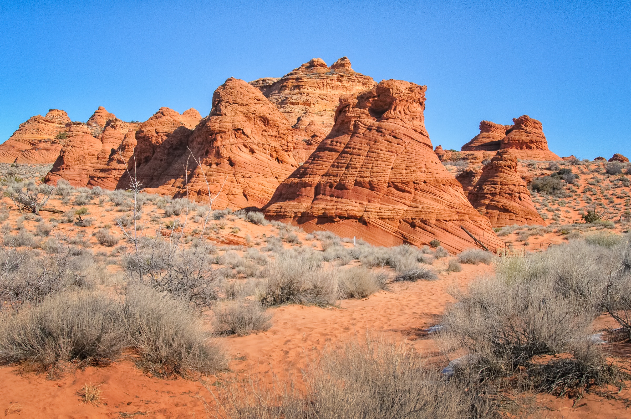
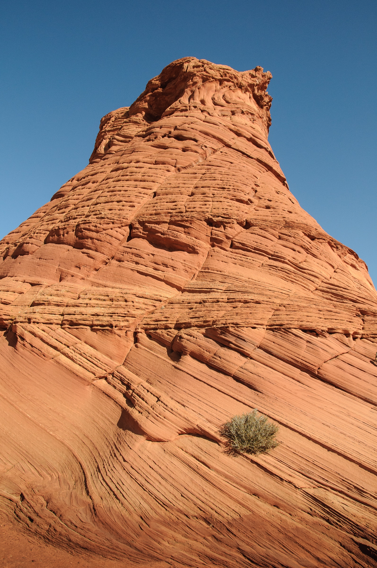
White Pocket
Another erosional landscape carved from the Jurassic-age Navajo Sandstone is White Pocket. However, this formation looks entirely different from The Wave. This is because massive white sandstone, weathered to look like cauliflower or a brain, overlays the familiar swooping and twisting red layers seen at The Wave.
This scenic area does not require a special pass. And, you can drive to it and park in a large parking area. You will, however, need a 4-wheel drive high clearance vehicle to make the journey through sand and, sometimes, mud.


The geological process that formed White Pockets is very complex and the subject of some differing opinions. The blog Cedar & Sand provides a nice simple explanation (plus some lovely photos, too). A more scholarly explanation is presented by Marc Deshowicz in his paper “An Earthquake-Induced Flash Flood Event within the Early Jurassic Navajo Sandstone, White Pocket, Vermillion Cliffs National Monument, Arizona.”
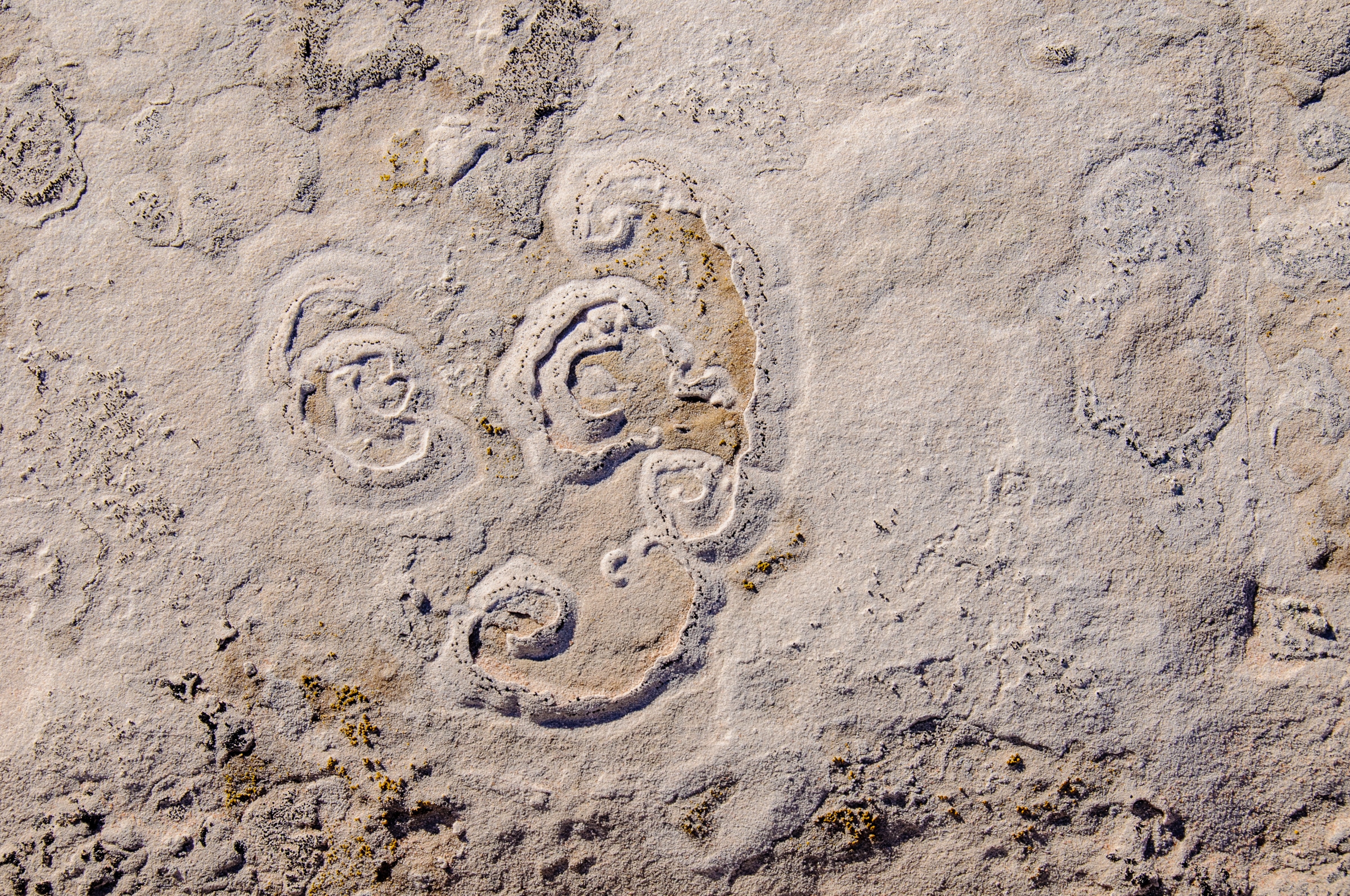
Paw Hole
The red sandstone teepees of Paw Hole are in the South Coyote Buttes area. Like the Wave, you will need a permit from the BLM to hike around this area.


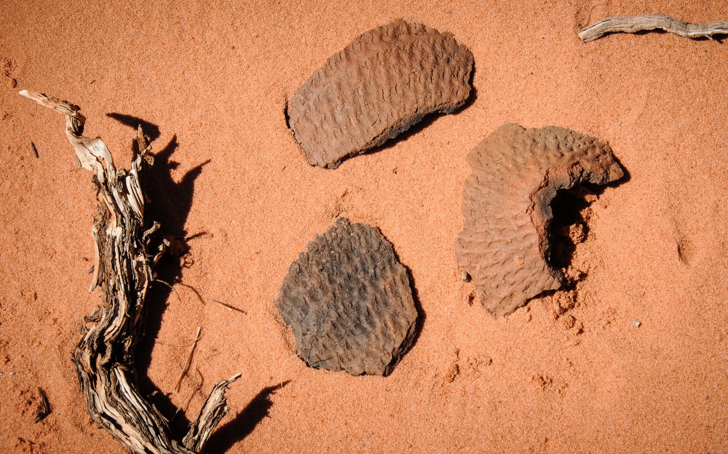
In any of these locations, you may see potsherds, arrowheads, or interesting mineral specimens. DO NOT TOUCH. Disturbing or collecting artifacts and specimens is against the law.
Purchasing photos from the Vermillion Cliffs
To purchase a license or print of any of these photos, please contact us All of our scenic and fine art photographs are available as fine art prints. Use the contact form to the right to get more information. Or, go to our Fine Art Print page to learn about various pricing options.