
Utah’s Capitol Reef National Park, near Torrey, exists to protect the area around a 65 million year old warp in the earth’s crust, called the Waterpocket Fold. Even more noteworthy, it is the largest exposed monocline in the United States.
According to the National Park Service, the name capitol refers to the white domes of Navajo Sandstone that resemble capitol building domes, and the name reef refers to the rocky cliffs that are a barrier to travel, like a coral reef. Domes and reefs are just the start of the wonders in the park.
Areas to Photograph in Capitol Reef
Capitol Reef is over 378 square miles in area. Because of its massive size, it is home to badlands, fantastical eroded stone monuments, arches, abandoned structures and vehicles, and diverse desert life.
As a result of this diversity, the best way to present my photographs is by main roads that traverse various areas of the park.
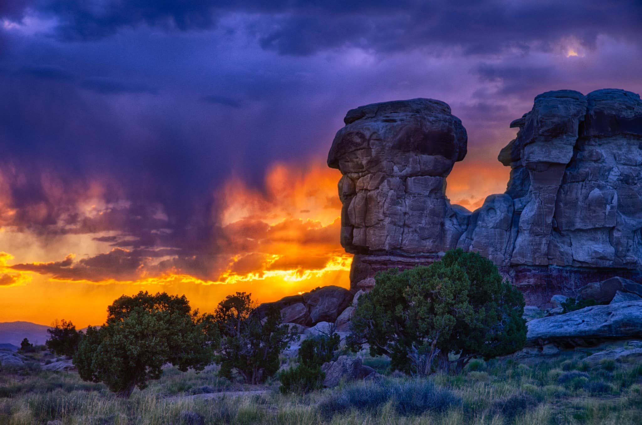
Utah State Highway 24
Utah State Highway 24 runs through Capitol Reef National Park from east to west—from Torrey to Caineville. Traveling this highway through the park will give you a good overview of the wonders the park offers.


Scenic Drive
Scenic Drive is an 8-mile (~13 km) paved road, with dirt spur roads into Grand Wash and Capitol Gorge that are dirt. Along with towering cliffs and the Fremont River, you will pass the beautiful orchards of Fruita, as well as the Gifford Homestead and the Mormon Schoolhouse. The fresh-baked pies at the Gifford farmhouse shouldn’t be missed!


Grand Wash and Capitol Gorge
Grand Wash and Capitol Gorge roads are short dirt roads that head east from Scenic Drive. Both are fairly accessible as long as it has not rained heavily.
Grand Wash Road
Grand Wash Road is about 1.5 miles and ends at a trailhead to Cassidy Arch. Along the road you will see some pictographs, oddly eroded sandstone, and the remnants of a uranium mine.


Capitol Gorge Road
Capitol Gorge is about 2.5 miles and ends at a trailhead to Capitol Gorge. the road is levely as it winds up through a canyon. Be sure to take the short trail further into the gorge, where you will see interesting geology, pioneer carvings, and diverse flora.


Notom-Bullfrog Road
This is a morning road! Notom-Bullfrog Road intersects Utah 24 nine miles east of the Visitor Center. It connects Notom to Bullfrog Marina near Glen Canyon Nation Recreation Area. For much of its length, it runs along the eastern side of the Waterpocket Fold. And, when the sun begins to rise, the brilliant colors of the rock layers in the fold are stunning!


Hartnet Road
Hartnet Road forms half the Cathedral Valley loop. To access the road, you must ford theFremont River, from Utah 24. So, we recommend a four-wheel drive vehicle with high clearance for this trip. Along this road you will see colorful badlands and abandoned vehicles. And, at the highest point (and the end of the road), you will be rewarded by a panoramic view into Cathedral Valley.


Cathedral Road
Cathedral Road forms the rest of the Cathedral Valley loop. It turns north off Hartnet Road and provides access into Cathedral Valley. It can be pretty rough and rutte. So, like Hartnet Road, we would recommend a high-clearance, four-wheel drive vehicle. Along this road, you will get up close and personal with the Temple of the Sun, the Temple of the Moon, and Glass Mountain.


 " data-envira-height="300" data-envira-width="199" />


Burr Trail
The Burr Trail turns off the Notom-Bullfrog Road and heads up into the canyons west of Capitol Reef. It is unpaved for 8.5 miles within the park, and then is paved from the park boundery to Boulder, Utah. It is a stunning road with several interesting spurs, such as Upper Muley Twist Canyon Road.


Upper Muley Twist Canyon Road
I separated this road from the Burr Trail because the scenery is unique. There are a number of arches to explore between the junction with the Burr Trail and the Strike Valey Overlook at the end of the road.


More information
For more information about the formation of the Waterpocket Fold and the stratigraphic column, read this National Park Service publication. For information about geologic features, such as arches and black lava boulders, read this Park Service publication.
More of photogenic Utah
In addition to Capitol Reef, here are some more locations on the Colorado Plateau in Utah that are worth your time.
Arches National Park
Bryce Canyon National Park
Canyonlands National Park
To purchase our photographs
All our photos are available to license or as prints. Please contact us using the form to the right and we will do our best to meet your needs. Here is more information about purchasing our fine art prints.